Explore over 2,500 Provincial Rec sites directly from BC Sites & Trails showing details from their website right on the map. Quickly browse:
The number of campsites
Vehicle Access Types like 2wd, 4wd, boat-in, or Motorhome
Trailer or Cartop Boat Launches
Nearby activities like, Fishing, Swimming, Hiking, Mountain Biking, Horseback Riding, Canoeing and more.
Top Notch Navigator also shows an additional 1,600 other campsites throughout the province.
Resource Roads and Trails
Not all forest roads are the same. Use the right tools to avoid inactive and deactivated roads. Top Notch Navigator is the only all-in-one map source that categorizes and color codes BC resource roads to make it easy to interpret their condition.
Traverse thousands of trails across the province for hiking, mountain biking, ATV’ing, snowmobiling, and horseback riding.
Logging Roads & Industrial Activity
Logging activity is updated annually and is highlighted with harvest dates to indicate road maintenance activity and improve your line of sight.
Old Growth & Forest Cover
Discover BC’s old growth forests and stand in the shadow of ancient giants.
Top Notch Navigator is the only publicly available map source showing mature coniferous and deciduous forest stands, color coding them by species and scaling the symbols by age to help users immerse themselves in the experience of BC’s diverse forests.
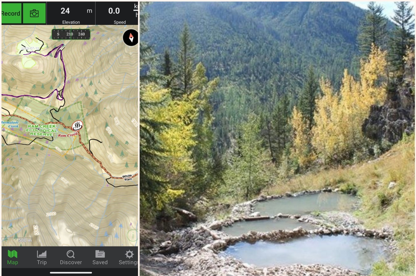
Hotsprings & Geothermal
Discover the tranquility of 170 hot springs and geothermal sites
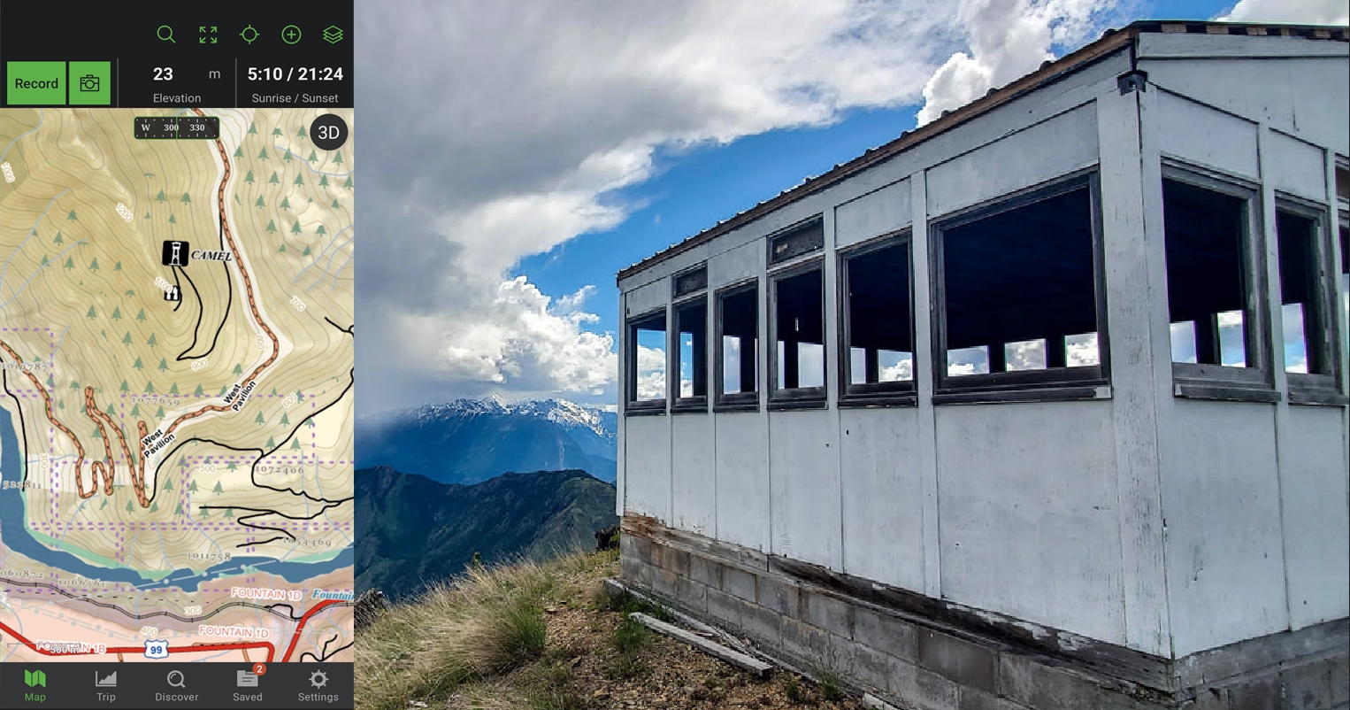
Fire Lookout Towers
Summit nearly 300 standing & decommissioned Fire Lookout tower locations
Dive Sites & Marine Data
Coastal Tidal Fishing Management Areas are shown alongside:
• Rockfish Conservation Areas
• Dive sites
• Marine Vegetation like Kelp Forests and Eelgrass
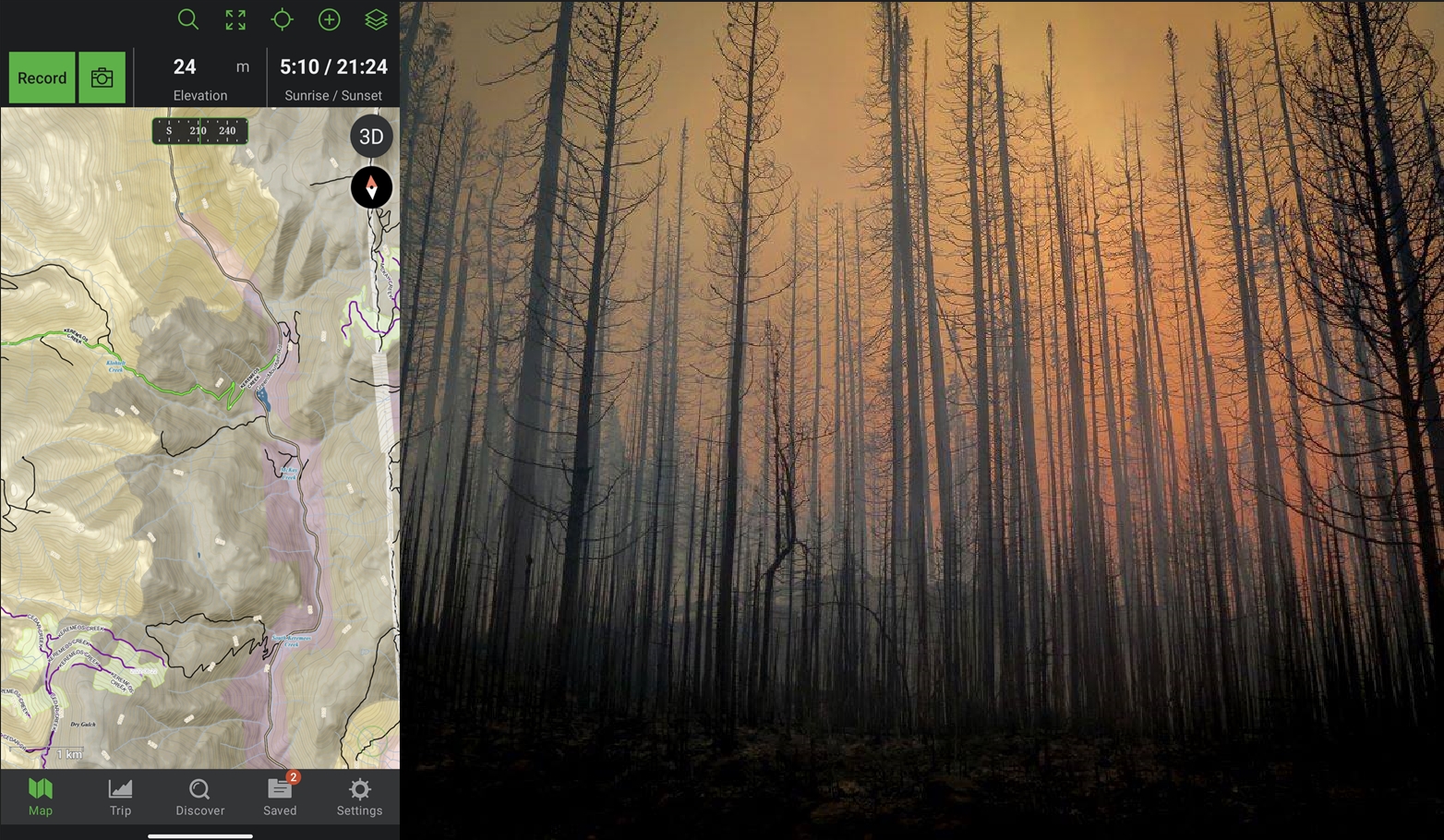
Current & Historical Wildfires
Wildfire perimeters from the past 10 years are shown on the maps, which are known morel mushroom hotspots and influence local wildlife behaviour and plant distributions.
This website uses cookies to ensure the best experience possible. More information...